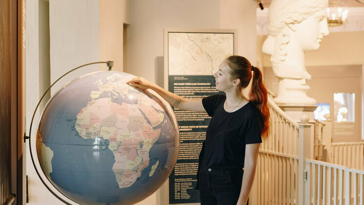
Geoinformatics for Urbanised Society
Master's
2 January
15 March
30 April
1 September
- The University of Tartu is ranked in the top 200 universities globally in geography (see Rankings and Surveys).
- Learn geography and IT in the age of big data and use it to analyse environmental and social processes for interdisciplinary decision-making.
- After graduation, you can work as a spatial data manager, spatial analyst, GIS consultant, urban and regional planner or pursue an academic career.
- Take part in different GIS-related events, summer schools and conferences such as Mobile Tartu and The Baltic Geospatial Information Technology Conference.
The 2-year master's programme in Geoinformatics for Urbanised Society prepares highly qualified specialists in handling and analysing spatial data to better understand the global environmental and urban processes and develop decision support systems for public, private, and non-governmental sectors.
Governance increasingly relies on sensors, BIG data, analysis, and fast decision-making in the global information society. Society needs experts who can handle geoinformatics tools to understand and find solutions to complex environmental and urban challenges related to climate and environmental change, growing social inequality, and increased spatial mobility. The master's programme focuses on building interdisciplinary competence by combining geography and IT. Particular emphasis is put on the problem-driven approach and development of students' practical skills.
- Learn modern techniques of analysing environmental and urban processes in the age of BIG data.
- Use spatial analysis tools to master the entire cycle of spatial data management, starting with fieldwork and data acquisition and ending with visualising planning solutions.
- Understand how to better plan contemporary urbanised societies at times of global warming, pollution concerns, increased global population mobility, ethnic integration, housing crises in the cities and urban poverty.
After graduation, young professionals can find employment in the public, private, or non-governmental sectors as spatial data managers, spatial analysts, GIS consultants, urban and regional planners. There are numerous further employment options in international organisations dealing with global processes, national, regional and local administrative offices responsible for environmental, urban, regional development and policy. Motivated students can continue their studies on the doctoral level and pursue an academic career.
Learning outcomes
Upon graduating, the student
- has a comprehension of geoinformatics and geodatabases and can use GIS software to handle spatial data;
- knows the geographical, social and economic processes in urbanised society as well as the related geodatabases;
- knows the environmental problems in urbanised society, the environmental technology and spatial databases used to manage and mitigate the issues;
- can use the contemporary analytical methods of spatial data and the cartographic methods to visualise spatial data;
- knows the principles and methods of spatial planning;
- has the skills to compile planning projects with the help of GIS software;
- knows the concepts of the information society, smart city and integrated planning and can implement them in planning;
- has acquired experience in teamwork and can work in teams;
- can give consultation within the field of specialisation;
- can participate in scientific research and has skills for academic writing.
The decision to pursue the master’s programme ‘Geoinformatics for Urbanised Society’ in the leading university of Estonia is not a regrettable one. It has been specifically tailored to produce professionals who will meet the demands of the industry today. The multifaceted nature of the program coupled with its interdisciplinary format is why I recommend this programme to anyone seeking further studies in the field of geoinformatics. By the end of the studies, you will be a GIS professional with an additional understanding of social and environmental processes needed for solving the pressing issues of today’s and tomorrow’s world. Tartu is a beautiful place to live and study in, and the Department of Geography of UT feels like home. This is why I am here!
Extracurricular activities
EGEA – European Geography Association for students and young geographers – unites the students of geography and geoinformatics. The active local club EGEA-Tartu organises various events and provides possibilities to participate in international conferences and seminars. By being an EGEA volunteer, the students are encouraged to participate at conferences organised by the Department of Geography, e.g. at the Mobile Tartu three-day event where the international community of location-based studies gathers. There are plenty of other professional seminars and conferences held in Tartu or in Tallinn where our students are participating, e.g. at the GIS Day and annual conference organised by Estonian Geoinformatics Society (ESTGIS).
The University of Tartu is one of the best universities in the Baltics. Estonia is well-known as a pioneer in information technologies and intelligent solutions. This makes the University of Tartu a perfect place to obtain a master's degree in 'Geoinformatics for Urbanised Society'. It is a comprehensive programme that opens good career prospects by providing theoretical knowledge and practical skills and allowing you to specialise in various geoinformatics-related fields. You will get the opportunity to apply the acquired knowledge in numerous practical labs and an internship. And last but not least – it brings together wonderful people with different cultural and professional backgrounds and allows us to exchange experiences and grow together professionally.
Programme highlights in video
- Watch the programme director talk about the master's programme in Geoinformatics for Urbanised Society during Virtual Open Day 2024.
- Watch the presentation about International master's admissions by the Head of International Admissions during Virtual Open Day 2024.
The master's programme prepares specialists and experts in spatial data management for various fields of life in the public, private, or non-governmental sectors. During the studies, the students are acquainted with the spatial processes and phenomena in the contemporary society and environment, such as migration, urbanisation, land use and climate change. In data-oriented courses, students get skills and expertise for obtaining, managing, analysing, and using data in spatial planning, decision-making, and policy development.
The 'Studio' course format combines data management and geography with high-level theoretical courses and the possibility of individually designing half of the curriculum with an excellent scientific team. It provides future alumni with a competitive advantage in the current job market.
The two-year master's programme consists of four equal cycles:
- intensive and practical studio format (30 ECTS)
- specialisation courses and work placement (30 ECTS)
- elective and optional courses (30 ECTS)
- master's thesis (30 ECTS)
During the first year, the students work half of their time in spatial data and planning project courses in 'studio' format. While the year starts with field works for data acquisition and moves on through the management of databases and data analyses, it ends with a well-visualised planning project prepared by the students using spatial data. As a result of the year, the students know and can choose and use proper geoinformatics tools and methods for quantitative analysis.
The spatial data and spatial planning studios are complemented by special courses in geography (urban social geography, geography of information society, energy fluxes and material cycles) and courses for developing students' practical skills (spatial data analysis, programming, project management). In addition, students can attend several optional courses in specific fields of geography, e.g. ArcGIS, geospatial analysis with Python/R, PostgreSQL/PostGIS, visual geodata mining, 3D modelling, applied remote sensing, introduction to urban planning, socio-spatial changes in cities in transition, economic geography of urban systems, or landscape ecology in urbanised society. Next to the courses provided by the Department of Geography, students can attend courses from other institutes to advance their skills in statistics, computer sciences, contemporary regional studies, or other fields.
After the first academic year, the 3-week-long internship (work placement) provides the student with practical experiences in solving real-life tasks in a team. An internship enables the students to broaden their understanding of working with spatial data and the arrangement of work in organisations and teams. It also helps to grow the professional network of students, either in Estonia or abroad. The department helps the students to find organisations for conducting the internship. For example, we have long-term internship cooperation with Regio, Positium, Hendrikson&Ko and Tõravere Observatory. The students may also apply for internships abroad, e.g. with the help of Erasmus+ Traineeship grant.
The students design the content of the second academic year by choosing courses that support specialisation and preparing the master thesis (20 ECTS) or optional courses according to the broad interests of the students (10 ECTS). The students are encouraged to spend their third semester of studies abroad as exchange students. The department has several partner agreements with universities around Europe to study as an Erasmus exchange student. The university provides additional opportunities to study worldwide with the help of bilateral partnerships with many universities. If staying in Estonia, the students are recommended to take courses on Estonian language and culture to better integrate into the society and professional culture.
The students work continuously on their master thesis during their studies, both individually under the supervision of the supervisor as well as in special master seminars. At the beginning of the fourth semester, an individually designed course about statistical methods supports the progress of the master thesis. The fourth semester is dedicated to writing the thesis.
ePortfolio
Our students are required to create ePortfolio during their studies. They will collate their works from different courses into ePortfolio. ePortfolios contain a wide range of works such as map designs, videos, animations, databases etc.
ePortfolio is a way to showcase the highlights of a student’s academic career. ePortfolio is a creative, flexible, and powerful tool for applying for a job, PhD position, starting a business, or becoming a freelancer.
ePortfolio enables to demonstrate skills and knowledge required for the job.
Course and module details
This programme structure is the latest one confirmed by the university. Next year's modules will be updated by 15 April. Significant changes to the programme will be announced in advance on this website. Check the Study Information System for the latest updates.
Curriculum version:
More info: Study Information System
People
| Course | Staff |
|---|---|
| Master's Thesis | Janika Raun (PhD) is junior research fellow in human geography. Her main research interests include tourism geography, consumer behaviour, destination functions, tourism impacts, destination marketing, and tracking technologies. |
| Spatial Data Studio, Spatial Data Analysis | Evelyn Uuemaa (PhD) is head of the Department of Geography and senior researcher in geoinformatics with a strong background in landscape ecology. Her main research interests are landscape analysis (especially quantifying spatial pattern), spatial analysis, landscape planning, water quality modelling in relation to land use changes. She has received EU Horizon 2020 Marie Curie fellow at the National Institute of Water and Atmospheric Research, New Zealand (2015-2017). |
| Spatial Data Studio, Geospatial Analysis with Python and R, Spatial Data Infrastructures | Alexander Kmoch (PhD) is a Post-doctoral Researcher in Geoinformatics with a strong focus on understanding, modelling, and managing spatial data. His interests include OGC standards and web services for environmental and spatio-temporal data sharing, modelling and 3D/4D interactive data visualisation. He has a background in computer science (BSc) and has worked in the IT industry in Germany for several years before completing his MSc in Austria and PhD in Geoinformatics in New Zealand. |
| Spatial Data Analysis, 3D Modelling and Analysis, Start-up Project | Raivo Aunap (PhD) is Associate Professor of Cartography. His main focus is on map design and drawing, terrain modelling, surveying techniques and map coordinate systems. As a Programme Director in Geography, Raivo is tightly working with students and engaged in the development of study programmes. |
| Introduction to Geographic Information System | Tõnu Oja (PhD) is Professor of Geoinformatics and Cartography. His main research interests are landscape metrics, uncertainties and relations to landscape consumption; spatial relations of real-world phenomena; nutrient cycling in the system plant-soil- atmosphere, environmental impact to spatio-temporal structure of nutrient cycling, dynamics and structure of forest ecosystems; sustainable development, including indicators and regionalisation. He is an expert on Strategic Environmental Impact Assessment. |
| Planning Project | Veronika Mooses is a PhD student in Human Geography at the University of Tartu. Her main research interests include ethnic and social segregation, human spatio-temporal behaviour, smart cities, and mobile positioning. |
| Planning Project | Siiri Silm (PhD) is senior researcher in Human Geography and her main research interests have been human geography and planning, space-time behaviour studies, ethnic segregation, social networks, seasonality of human activities, mobile positioning. |
| Geography, Communication and Spatial Mobility, Geospatial Analysis with Python and R | Anto Aasa (PhD) is senior researcher in Human Geography at Tartu University and his research interests include the GIS, spatial statistics, geovisualisations, spatio-temporal behaviour of people, mobile positioning, information and communication technology, bioclimatology, and phenology. He has been active in developing mobile positioning based research methodology. |
| Planning Project | Pille Metspalu (PhD) is geographer and has been active in the field of spatial planning for over 20 years. She is the leading regional and master planning consultant in Hendrikson&Ko Ltd, a lecturer of spatial planning at the University of Tartu. Her portfolio as a planning practitioner contains a large number of various planning projects, including Rail Baltic railway, marine spatial planning and more than 70 comprehensive plans for towns and rural municipalities. P. Metspalu has been active in developing planning methodology, she is the author of several planning guidelines. She is a member of the board of the Estonian Association of Spatial Planners and Professional Planners’ Licensing Committee. |
| Planning Project, Demography and Urban Social Geography | Ingmar Pastak is a PhD student and junior researcher in Human Geography at the University of Tartu. He has worked on the European Union-funded research project DIVERCITIES, which examined how cities can benefit from urban diversity in terms of social cohesion, social mobility and entrepreneurship. His PhD research focuses on the influence of public and private sector-led urban revitalisation projects in deprived neighbourhoods and displacement pressure caused by revitalisation and gentrification. His main research interests include urban revitalisation, gentrification, socio-spatial inequalities, urban governance and urban diversity. |
| Energy Flows and Material Cycles | Ülo Mander (PhD) is Professor of Physical Geography and Landscape Ecology. His main research areas are carbon and nutrient cycling in landscapes, constructed wetlands, green infrastructure. He belongs to the 1% of the most-cited scientists in the field of ecology and environmental sciences. He has been visiting scientist/visiting professor at various universities and research centres (University of Kiel, Lund University, University of Linköping, Norwegian University of Life Sciences, National Agricultural Research Center for Hokkaido Region, Ohio State University, French National Institute of Science and Technology for Environment and Agriculture (IRSTEA). The Estonian government has awarded him with the National Science Award in the field of argicultural sciences in 2000 and in the field of bio- and geosciences in 2012. |
| Energy Flows and Material Cycles | Ivika Ostonen (PhD) is senior researcher in Landscape Ecology and she has a background in plant ecology and ecophysiology. Her main research interests are root ecology, biodiversity and ecosystem functioning, biomass allocation patterns in global change, production, decomposition and nutrient cycling in belowground of different ecosystems, ecosystem adaptation mechanisms in global change, C and N stores and fluxes. She has worked as an ecologist in climate experiments and along natural gradients (boreal-temperate forests, soil warming, and fertility). Estonian Government has awarded her the National Science Award in the field of agricultural science in 2014. |
| Geography, Communication and Spatial Mobility | Matthew Zook (PhD) is Professor of Information and Economic Geography in the Department of Geography at the University of Kentucky where he directs the DOLLY project, a repository of billions of geolocated tweets. His research focuses on the production, practices and uses of big geodata. He studies how code, algorithms, space and place interact as people increasingly use mobile, digital technologies to navigate through their everyday, lived geographies. Of special interest is the duplicitous manner that code and content can congeal and individualize our experiences in our digitally augmented cities. He has served as a Fulbright Fellow at the Mobility Lab at Tartu University, (2013-14), a visiting Fellow at the Oxford Internet Institute (2014), and a visiting scholar at the University of Auckland (2016-17). He is currently the managing editor of Big Data & Society and a co-editor of the AAG’s new journal, GeoHumanities. |
| Demography and Urban Social Geography, Demography, Global Migration and Contemporary Cities | Tiit Tammaru (PhD) is Professor of Urban and Population Geography and a visiting researcher at Delft University of Technology. His research interests include migration; residential mobility and neighbourhood change; and integration and segregation of ethnic and social groups over multiple life domains (family, places of residence and work), also in comparative urban studies, and he is the editor of the book Social Segregation in European Capital Cities (Routledge 2016). He is among the top-cited researchers in the field of urban studies in Eastern Europe. He is leading the development of longitudinal linked censuses and registers data for urban and population geographic studies in Estonia. The Estonian government has awarded him with the title of social scientist of the year 2011. |
| Demography and Urban Social Geography, Demography, Global Migration and Contemporary Cities | Anneli Kährik (PhD) is a senior researcher in urban geography at the Department of Geography, University of Tartu. She has a particular interest in population, urban and housing research, and her research currently focuses on residential segregation, ethnic integration, and neighbourhood processes with a particular focus on Eastern Europe and Nordic countries. |
| Course | Staff |
|---|---|
| Visual Geodata Mining | Jukka Matthias Krisp (PhD) is a Professor of Applied Geoinformatics at the University of Augsburg, Germany. His current research interests include Location Based Services (LBS), Geovisualization, Visual Data Mining and Geographic Information Systems (GIS) applications in ecological network planning. |
| Spatial Databases, Spatial Data Infrastructures | Valentina Sagris (PhD) is researcher in Geoinformatics. Her main research interest includes conceptual geospatial modelling and database modelling with application for agriculture and biodiversity; land use mapping with remote sensing and compilation of CORINE Land Cover databases in Estonia; land use mapping of cities and studies on urban sprawl in Europe. Recent research projects explore application of thermal remote sensing in an urban environment (urban heat islands) and wetlands ecology. |
| ArcGIS Software, Spatial Data Analysis | Kiira Mõisja (PhD) is a specialist in geoinformatics and she has profound experience in cartography and topographical data management. She has published many maps and worked at Estonian Land Board where she was responsible for topographical mapping. Her main research interest is spatial data quality. |
| Data Science in Remote Sensing | Krista Alikas (PhD) is a researcher in the Remote Sensing Department in Tartu Observatory, University of Tartu. Her research interests are satellite-based applications for monitoring inland and coastal waters for water quality studies and management purposes. She has been actively involved in European Space Agency satellites ENVISAT/MERIS and Sentinel-3/OLCI validation teams. |
| Introduction to Urban Planning | Daniel B. Hess (PhD) is Professor of Urban Planning in the School of Architecture and Planning at the University at Buffalo, State University of New York (USA). Trained as a civil engineer and urban planner, his scholarship explores how transportation, housing, and access foster social and economic functions of cities. Recent research projects in Estonia explore the legacy of town planning and how the wide-ranging effects of various occupations affect local and national planning systems and planning practice. His research also seeks to explain housing systems and historical and current population dynamics to explore the effects of inherited segmentation from state socialism. |
| Economic Geography of Urban Systems | Frank Witlox (PhD) is Professor of Economic Geography at Ghent University, a Visiting Professor at Tartu University and an Honorary Professor at The University of Nottingham. His research focuses on travel behaviour analysis and modelling, travel and land use, sustainable mobility issues, business travel, cross-border mobility, city logistics, global commodity chains, globalization and world city-formation, polycentric urban development, and locational analysis of corporations. He is the chairman of the Benelux Interuniversity Association of Transport Economists, of the Institute of Sustainable Mobility at UGent, and of the Belgium Institute of Transport Organizers. He is the Editor-in-Chief of Journal of Transport Geography and an Associate Editor of Tijdschrift voor Economische en Sociale Geografie. |
| Work Placement, 3D Modelling and Analysis | Merle Muru (PhD) is a researcher in Geoinformatics. Her research interests are landscape modelling and relief analysis. Her research is focused on palaeogeography, reconstruction of past sea-level changes, morphology and evolution of coastal areas, and patterns of prehistoric human settlement. |
| Work Placement | Garri Raagmaa (PhD) is Associate Professor of Regional Planning. His research area is about regional planning and development focusing on regional innovation, entrepreneurship, identity and leadership issues. He has taught regional planning, economic geography and regional innovation systems at several Nordic and Baltic Universities. He is a national representative of the Regional Studies Association and the Association of European Schools of planning as well as a member of the Association of Estonian Planners and the Estonian Economic Association. |
| Project Management | Kairi Põldsaar (PhD) Kairi Põldsaar is Geology Senior Specialist and Program Manager of geology and environmental science curriculas. Her main research interests are sedimentology and stratigraphy, with special focus on high energy marine and coastal processes and reconstruction of ancient sedimentary environments. In addition to scientific research, she has also actively contributed into science popularization for the past 10 years. She has been the curator of many successful science exhibitions, written and managed numerous science popularization related projects, composed and published printed and interactive educational materials for schools and public and organised various public events. |
Facilities

As a student, you will spend most of your study time in the historic study building at Vanemuise street 46, located in the central city, a 15-minute walk away from Town Hall Square. The building hosts the Department of Geography, the Department of Zoology, the Dean’s Office of the Faculty of Science and Technology, and the Natural History Museum. The museum affiliates zoological, botanical, mycological and geological collections and opened a new permanent exhibition ‘Earth.Life.Story’ in 2016. Access to the museum is free of charge for the students.
The study building includes free usage of the computer lab for our students. Computers are equipped with spatial analysis software and enable the fulfilment of all assignments required during the studies. During your spare time at the study building, you are welcome to use the cosy coffee room of the Department of Geography.
Tartu - the Student Capital of Estonia
As a student of the University of Tartu, you will quickly lose your heart to the city. Tartu is famous for its cosy historic campus area intertwined with the city centre and parks. The first compact university campus was founded in the beginning of the 19th century during the Age of Enlightenment. This compelling complex of classical style buildings mixed with greenery still forms the city's core.
Along with the evolving needs of research and education, campus development in Tartu has been transforming into a contemporary well-integrated and connected university town that wisely, delicately, and innovatively combines the historical heritage with current needs. Modern and historical but renovated study buildings with necessary labs and equipment provide an excellent study environment for our students in the central and the Maarjamõisa campuses. The latter, being located approximately 2–3 kilometres southwest of the downtown area, hosts natural and medical sciences together with the nationally leading university hospital.
The most recent landmark of the campus development is the newly opened university library. The renewed library provides various contemporary study options where access to academic literature in digital and traditional formats, as well as provision of physical study spaces, are its key services. The renewed library has 13 group rooms where you can study with a group of 4-15 persons. It also provides private workrooms which can be rented for private study or research work from one hour to one semester. The University of Tartu offers wireless internet service in most of its buildings, including the University of Tartu Library. Using WiFi is free of charge for all users and visitors of the UT Library, the period of use is not limited. Located just between the Town Hall Square and our study building, you will certainly find your way to this academic hub of knowledge, people, and good thoughts.
Please explore the campuses of the University of Tartu via virtual tour.
The University of Tartu together with other higher education institutions – the University of Life Sciences, Tartu Health Care College, the Estonian National Defence College, the Estonian Aviation Academy, Tartu Art College, and Tartu College of TalTech– commonly make up the image of Tartu as a university town. The employment of nearly half of the working-age population of Tartu is associated with higher education institutions.
Universities make Tartu a vivid and vibrant city that is filled with students. The students of the University of Tartu alone represent over 10% of the city’s population. There are always plenty of opportunities to be engaged with various social events and initiatives or become a member of student communities and associations.
Many sporting facilities, a green corridor along the River Emajõgi, and good quality cycling routes help to keep students physically active. In addition, Tartu is a compact city where everything you need is within walking distance.
Tartu does not provide only physical, but also digital proximity to all the places and services you need! Public or university-related WiFi connections enable you to access Internet almost everywhere in the city. For example, you can easily chat with your family and friends back home over smartphone apps everywhere in the town. Estonia is well known for its technological development, digital services and platforms that make everyday life comfortable and time use efficient. Take a look at our e-Estonia digital society.
Tartu provides an affordable living environment that is a strong incentive to move to Tartu for your studies. Monthly living costs are approximately 450 € in Tartu. These include living expenses and health insurance but do not cover the tuition fee.
Glance at dormitories for international students.
From the blog of our International Student Ambassadors you can find more helpful posts to get acquainted to the city and its surroundings.
Modern life relies increasingly on BIG data and digital work processes – geoinformatics helps manage and analyse historical and real-time spatial data to support decision-making and policy development.
Successful completion of the master’s programme ‘Geoinformatics for Urbanised Society’ enables employment in all sectors as a spatial data manager, spatial analyst, or GIS consultant for planning and regional policy. The alumni work in several local, state, and EU institutions, consultancy companies for planning and environmental management, or companies that provide location-based analyses and IT services or cartographical solutions.
The following list of domestic and international companies and institutions shows where many of our alumni with GIS specialisation have found employment:
Regio, ReachU, Positium LBS, CGI, TerraPro, Navionics, Affecto, Telia, Hendrikson&Ko, Estonian Land Board, Estonian Agricultural Registers and Information Board, Environmental Board, Environmental Agency, Estonian Defence Forces, Estonian Weather Service, Met Office, Tartu Observatory, Tartu City Government, Tallinn City Government, ESPON.
Admission requirements for Geoinformatics for Urbanised Society
- bachelor’s degree or equivalent qualification (must be obtained by the end of July) – please see our country-specific document requirements
- prerequisite courses: at least 30 ECTS (one semester) completed in the previous level of studies either in geography, geoinformatics, information technology, environmental technology, planning, geology, ecology, biology, environmental physics, economy, sociology, or government and politics.
- English language proficiency – please see our acceptable tests and exempt categories
NB! The restrictions for the citizens of the Russian Federation are specified here.
Applications are evaluated based on
- average grade of the previous study level (yields 50% of the final score)
- the score of the motivation letter (yields 50% of the final score)
The motivation letter (in English, maximum of 4600 characters with spaces) should be based on the following points:
Describe what field-related skills and knowledge you have acquired through previous education and working experience (if applicable) and how these match or are relevant to the content of this master´s programme.
Analyse how the master's programme in Geoinformatics for Urbanised Society can contribute to your personal development.
Describe your current ideas about a research topic you would like to focus on during your master's studies.*
* Research topic described in the motivation letter is not binding and may change during your studies
In the evaluation of motivation letter, the following criteria will be considered:
- Compatibility of interests and the issues raised in the motivation letter with the goals of the master’s programme (50 %)
- Analytical and argumentation skills (30%)
- Self-expression skills and fluency of written English (20%).
The maximum score for motivation letter is 100 points and the result is positive only if the applicant gains 51 points or more.
Only those applicants who score 66 points or higher out of 100 as a combined score from both the motivation letter and GPA will be considered for admission.
Further information on assessing candidates´ academic performance and calculating admissions´ score.
How to apply
The following information applies to international students and Estonian students who graduated abroad:
The application system opens on 2 January and closes on 15 March. The following documents must be submitted electronically via DreamApply by 15 March:
- online application
- motivation letter
- official certified copy of the bachelor's diploma or its equivalent and Diploma Supplement (transcript) in the original language (must include a description of the grading scale).
NB! Applicants graduating in the upcoming spring/summer and having their diploma and final transcript issued later than the application deadline should electronically submit their most recent official transcript by the application deadline. The transcript should be supplemented by an official statement from the issuing institution indicating current enrollment and expected graduation date. Admitted candidates are required to post certified copies of their graduation documents as soon as these have been issued (must reach us no later than by the end of July). - official translation of the bachelor’s diploma and Diploma Supplement (transcript) into English, translation certified
- proof of English language proficiency
- copy of the passport page stating the applicant’s personal particulars
- confirmation/receipt of application fee payment (if applicable). All international applicants are required to pay the application fee EUR 100, unless they have completed the previous study level in Estonia. An application will only be processed after the fee has been received by the UT.
Submitted applications can not be edited. It is only possible to upload new documents (e.g. graduation certificates). Applicants will receive feedback and notifications through the DreamApply system to their e-mail. Incomplete applications or those submitted by e-mail will not be considered for admission.
Guide to submitting an electronic application on DreamApply.
NB: The University of Tartu has no official partnerships with agents or educational representatives. We strongly recommend applying directly to the university without the help of unauthorised third-party entities. Should you use such a service, please ensure that your application's contact information is your personal details (your e-mail, phone number, etc.).
The evaluation of applications will be made based on the electronic copies added to DreamApply. A general ranking list will be formed based on the electronically submitted applications and admission results (including offers) will be announced to all applicants personally via DreamApply by April 30 at the latest. Admitted candidates are expected to accept or decline the offer in DreamApply in 7 days. If the decision is not communicated to UT via DreamApply by the stipulated deadline, UT reserves the right to withdraw the admission offer.
NB! It is not possible to postpone the beginning of studies to the next academic year.
Terms and conditions of the admission offer
Admission offers are conditional. This means that there are conditions in the offer which the applicant needs to fulfil in order to be admitted (e.g. sending application documents by post; obtaining the required level of education). If the conditions are not met, UT has the right to withdraw the offer. Also, UT reserves the right to withdraw or amend any offer or revoke the matriculation of a student, if it becomes evident that the application contains fraudulent information, the qualification does not provide access to the chosen study programme or the student is found to have omitted key information from the application. Should such circumstances occur, UT will not be liable for any material or immaterial loss which the student may suffer as a result.
Once the admission results have been announced, all admitted students are required to send the application documents by post to: Student Admissions, University of Tartu, Ülikooli 18-133, Tartu 50090, ESTONIA.
The documents are expected to be mailed only by those receiving the admission offer (unless instructed otherwise by the admissions staff). The documents must reach the university within 3 weeks from the announcement of the offer. If the application documents do not reach us by the deadline, the university has the right to withdraw the admission offer. Applicants will be informed when their documents have arrived.
Requirements for educational documents
All copies of educational documents (diplomas and Diploma Supplements/transcripts) must be officially certified. By certified we mean that the copies should bear an original signature and seal of the authority certifying that these are true copies of the original document(s). The copies can be certified either 1) by an authorised official of the issuing institution, or 2) by a notary, or 3) with an Apostille attached. NB! Country-specific requirements may also specify the way documents from certain countries must be certified.
Please note that UT does not accept simple copies made on the basis of already certified copies (primary copies are needed).
All admitted students are required to present their original qualification certificates upon arrival (unless these were sent directly from the issuing institution).
Paying the tuition fee (applicable to those receiving a fee-based study place offer)
- EU/EEA/Swiss citizens are required to pay the fee for the first semester once they arrive in Estonia (by 20 September at the latest after signing the fee contract, please read more here).
- Admitted students from other countries are required to pre-pay half of the first semester's tuition fee. The invoice along with the pre-payment deadline and payment details will be sent to applicants via DreamApply after they have accepted the admissions offer and the University has received the hard copies of the application documents. Second part of the fee is due on 20 September. NB! The official admission letter (necessary for visa application) will only be issued once the University of Tartu has received the pre-payment.
- NB! Once you have been offered a fee-based study place, be aware that it will not be changed into a fee waiver study place. By transferring the pre-payment to the university, you confirm that you have informed yourself about the process of the visa and temporary residence permit application and you are able to arrive in Estonia by the start of the academic year. If you have any questions please contact studentvisasupport@ut.ee.
The official admission letter will be sent to admitted students electronically via DreamApply only after the admissions office has received and reviewed hard copies of the application documents, and received the tuition fee pre-payment (if a pre-payment was required, please see step 3 for more details).
NB! The electronic admission letter is also sufficient for non-EU students for applying for visa/residence permit at an Estonian embassy.
Once the admission letter is issued, accepted students may proceed further with arranging their arrival. All non-EU students should first consult information on the process of visa and temporary residence permit application to be sure, as where and when the relevant documents need to be applied. Note that housing at the UT dormitories can be applied during a limited period of time, unless specified otherwise on the website.
NB! Admitted students who are not citizens of an EU or EEA country or Switzerland need to make sure they obtain the Estonian long-term visa on time in order to be able to participate in the orientation programme for international students held in the last week of August. They are also required to visit the Admissions Office in person to complete their arrival registration by September 1, 2025, at the latest. Failure to do so will result in the revocation of their admission decision and visa.
For housing alternatives please find further information on Tartu Welcome Centre website. Travel information can be found here. Based upon common queries, the most important information has been summarised into a pre-arrival information website UT Getting Started.
Estonian applicants should apply via National Admission Information Systems (SAIS). Further information in Estonian is available here.
Student Admissions
Student shadowing
Live one day as a University of Tartu student by shadowing a current student. Register here.


07.02.2025